Friday, January 28, 2011

Walk Number 3....Cape Surville 26/1/2011

After consultation with my walking partner Amanda we have decided to tackle the Cape Surville walk. The rugged scenery and coastal forest make the Cape a very attractive destination and some of the geology is unique outside of Antarctica.  This walk is listed in my book as a medium grade which means it is suitable for walkers of average fitness, is on marked tracks or routes, some of which are rough or overgrown.  There are some long steep gradients and there are natural obstacles such as rocks and fallen logs to negotiate. The walk is listed as taking four and a half hours return.


We set off from home at 8.00am and head to Murdunna where the walk begins. Murdunna is a small town approximately an hour out of Hobart.  First stop was Dunalley Bakery where I picked up an egg and bacon pie for brekkie....all good, would be walking it off soon enough, well that's what I told myself!  


Getting there:- Turn left off the Arthur Highway at Murdunna into Hylands Road. Follow this gravel forestry road for 9.4 km until you come across a carpark on the left after a creek crossing. To the east of the carpark is Richardsons Rd which is where we head.  Follow this road for about 40 minutes until you cross Chasm Creek.  Shortly after the creek turn right into the track with a sign marked "Cape Surville".  


While the sign says 2 hours return for this walk there is no way you could complete it in this time...you need to allow 3 hours at the very least.  


Before we embark on the walk I'll just go through what I've packed in my backpack for today's trek.  Sunscreen (of course!), 3 drink bottles, lunch plus snacks, a basic first aid kit and mobile phone.  Not a lot but I think I have covered the basics....didn't need anything I didn't have on this occasion. It has been suggested to me that I should carry an EPIRB, which I am considering.


The track climbs gradually and after walking for about 10 minutes we come to a small clearing near the cliff edge with views over the ocean.  There is a small track leading a little further down the cliff face which we decide to investigate as the view of the water is obscured by trees.  As this track is quite steep we feel it's only safe to go down about halfway but this is far enough to get a better view and a good photo.


Photo opportunity taken and back safely up onto the main track. There was one casualty though....my sunglasses...they must have fallen off my cap as I was climbing back up the track.  I was tempted to go back and look for them but standing at the top and looking back down I quickly had a change of mind....some wallaby is quite welcome to a 20 buck pair of sunnies.        


heading down track

view from cliff top

Moving on from the clearing we now face a very steep and rocky track...the track is not always clear but with the help of orange tapes along the way we manage to find our way.  Just a bit of advice...when looking for the tapes don't always expect them to be nicely positioned at eye level, we found that quite often they were tied to a small shrub, a fallen branch or just poked obscurely into a gap in a tree.  


After about half an hour the track descends into a sheltered valley..it's quite a surprise and just beautiful. While resembling a cool temperate rainforest, by definition it is actually 
known as a mixed forest as there is more than 5% cover of eucalypts.  Underneath the large eucalypts is an understorey of Musk, Dogwood and Bedfordia, together with the rainforest species Sassafras and some very tall Treeferns.  This area is such a contrast to the terrain we have just walked through.  In the middle of it all is the most magical little babbling creek, it reminded me of the fairy glades I use to read about in my Enid Blyton books when I was young...ahhh so lovely.  Took the opportunity to refill the drink bottle with the crystal clear water from the creek.


Time to move on from this little piece of paradise and back to the reality of the toughness of this walk.  We now climb steeply...very steeply!! to a little rocky outcrop which takes in views of High Yellow Bluff and Maria Island.  This is the great thing about these walks...it's a lot of effort and at times extremely challenging but the views that are experienced are breathtaking. Equally welcome was the sign telling us that Cape Surville was only 15 minutes away!!
                                  
High Yellow Bluff


We now head east along the clifftop and onto a narrow ridge with the cliffs falling away steeply on both sides of the track...not for the fainthearted!  With only a turn of the head there is a spectacular view of High Yellow Bluff on the left and to Sisters Rocks and Deep Glen Bluff on the right...magnificent!!
Deep Glen Bluff

Some information for the geologically inclined...the cliffs to the right are like a huge layer cake, with the lower section composed of Devonian granite and the upper of Permian sandstone and mudstone.  Cutting through these is an instrusion of black Jurassic dolerite. The fact that how this intrusion occurred can be seen in the cliff face makes this site unique...oh, and a geek's dream!  By the way I did do a bit of research on the composition of the cliffs, haven't just made it up....my Year 12 geology teacher would be so proud!!

Sisters Rocks

The track now continues along the south side of the headland until after a short walk we can climb up to the crest....yes we made it!!!


We're on top of the world...at least that's how it feels....2 and a half hours after leaving the car we have reached our destination, and it feels great! Time now for some lunch and a rest before embarking on the return trip.

The trek back takes us about an hour and a half...so the sign saying the walk is 2hours return is a complete firthy..no way, even allowing for lots of chat, photo ops and getting stuck under fallen trees, there's no way the walk could be completed in this time.

Once back at the car and after a short recuperation it's time to hit the road and head straight for the closest pub...cascade ale here we come!! 

One of the great things about doing these walks is the companions that have accompanied me...all top class!  Thanks Amanda for making this one so enjoyable...a great day!
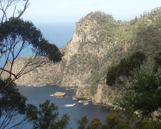
looking back to where we'd been.....the top of the crest was our destination

Tuesday, January 25, 2011

Planned walk for Australia Day

I've finally been able to coerce someone into taking on a walk with me.  Being a public holiday for Australia Day, the 26th of January was the next available day to take on another walk.  My good friend Amanda was very keen to accompany me on the next adventure. There are a couple of options I can take....do a long walk that will take up most of the day or try and knock over a couple of short walks to make an indent into the 35 walks I'm going to undertake this year.

The options include a 4 and a half hour return walk to Cape Surville, a 3 hour return walk to Clemes Peak and Tatnells Hill, a walk from Camp Falls to Waterfall Bluff (2 hours return), or some short hour walks. My preference is the longer walks, but I'll wait until my fellow hiker arrives early tomorrow morning to decide which option we will take.

Saturday, January 8, 2011

Walk Number 2......Shipstern Bluff 30/12/2010

This is a walk I've been wanting to do for quite a while..... well today's the day!

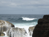
Shipstern is in the Western part of the national park and is a mecca for surfers, who consider it one of the heaviest breaks in the world.  Check out these images...not taken by me, unfortunately:


This is a four hour return walk, and while no previous bushwalking experience is necessary you do need to be reasonably fit and be able to cope with uphill walking.


For this walk I had my sister accompany me which was a real treat as we'd never done a walk together before.  The day was fine and mild...perfect walking weather. This walk starts at Stormlea which is easily found...if travelling from Port Arthur head towards Nubeena until you get to the Highcroft/Stormlea turnoff (approx. 8 klms) then a 15 min drive on a dirt road following the 'Cape Raoul Walking Track' signs until you can't go any further.  The road narrows at this point and becomes a single track. After leaving the car we headed towards the walking track sign.  Interestingly on our left in a paddock was a public sauna, available for anyone's use.  Personally I think a spa would be more beneficial at the end of the walk...but then that may be just me! 


There is a 200 metre walk through private property before getting to the actual start of the walking track. Now this is a little confusing...straight ahead is a gate laying on the ground, which we merrily stepped over and continued on our way.  After walking for about 10 minutes the track started becoming quite unclear and extremely rough.  It was at this point that we decided to back track...great decision...got back to the flattened gate and noticed to our left a sandstone stairway..yep this was where we were suppose to go.  Phew, who knows where we would've ended up!


Anyway, now back on track (literally!) we walked on a well worn track for about half an hour until the track divides, Cape Raoul track heads left and Shipstern Bluff track heads right...this is very clearly marked! The track from now on, while generally quite clearly  marked is a little rough in places. There are some areas where it's not so clear but there are blue ribbons attached to trees at these spots to follow. The next point of interest, about an hour into the walk, is a viewing platform which looks down over the bluff. I read somewhere that some people turn back at this point because the waves don't appear to be anything out of the ordinary from this view.  I must say this is quite true....while the aspect is beautiful it's nothing out of the ordinary from other vistas we are use to from living in this spectacular place. 
With the photo on the right I've tried to show the steepness of the terrain...not sure if I've succeeded though...you'll just have to take my word for it!


After the obligatory photo taking we continue on with our trek.  At this stage of the walk the track starts descending, in places, quite steeply and becomes nothing more than what could kindly be described as a goat track...a very skinny goat I might add! Having successfully negotiated this part of the track we ended up on level ground and followed a sandy trail for another 30 minutes or so until we came to a junction...Shipstern left, Tunnel Bay right...as Shipstern was our destination left it was.  The anticipation of finally arriving at our target was building...can't be much further now..we could hear the crashing waves, smell the salty air..must be just around the next corner!  Disappointingly no, not to be...just around the next corner we were confronted with another steep decline which couldn't even be described as a goat track more like a rabbit track.  It was at this point we decided to stop for sustenance and contemplate whether or not to continue on down the hill. Hey, we'd come this far we need to continue.


Being the younger and more adventurous sibling (ha) I went down the track first...because of the steepness I decided the best way to traverse it was being as close to the ground as possible, and what part of me is closest to the ground..my backside!  So here I am sliding happily down towards my destination when I look back and see a young guy at the top of the track who has obviously decided that the best way for him to descend is as fast as possible.  He starts running down the track...great...now I need to get a move on otherwise I'm going to get run over by this lunatic, so it's back up on my feet and off I go...wee...not the preferred way but certainly alot quicker than I had been going.  


Having safely negotiated my way to the bottom (more through goodluck than good management) the scene that met me was breathtaking.  I was in awe of the ruggedness and fierceness of the area.  I just can't explain how magnificent it is and unfortunately the photos I took don't show its true beauty...you need to get down there and experience it for yourself.


After spending over half an hour marvelling at the magnificence of it all and also pondering the mind set of surfers who actually surf this area we started on the return trip. While the ascent was quite steep I found it much easier going up than coming down.  Once again the old heart was getting a good work out as well as the legs, but the uphill hike was very satisfying.


As stated earlier a reasonable level of fitness is required to complete this walk but the sense of achievement at the end is very exhilarating.


Wednesday, January 5, 2011

The idea starts

For a while now I've been thinking that undertaking some activity and creating a blog about it would be a pretty cool thing to do.  The initial idea came after watching the movie Julie & Julia. For those unfamiliar with the plot Julie Powell, a frustrated office worker & cookbook inspired fledgling writer, undertakes the challenge to whip up the 524 recipes featured in renowned cook Julia Childs' book 'Mastering the Art of French Cooking' in 365 days. To introduce a new generation to the magic of French cooking she blogs of experiences with each recipe.


So what was my activity to be?  I love the outdoors and I love the Tasmanian environment so something around these things seemed the obvious choice. I have a shack on the Tasman Peninsula and although I've owned it for ten years I hadn't done any of the walks around the area.  This Christmas break I decided to check out a couple of the closer ones to my shack.  When I was checking out info on the internet I came across reference to a book produced  by Peter and Shirley Storey on walking on the Tasman Peninsula...35 walks in and around Tasman National Park. Bingo!...that's it...the perfect fit. 


I'm a small business owner and mum to 3 children, both of these things take up a lot of my time and can be challenging but I wanted to set myself a personal challenge, so this is it....complete the 35 walks and share my experiences.  While the Storey's book provides comprehensive info about the walks, the terrain, preparation etc I want to give readers information from the perspective of someone who has little knowledge but a heap of enthusiasm and hopefully can encourage a couple of people at least to get out and enjoy the great natural environment that's right outside our back door.


So here goes....