We set off from home at 8.00am and head to Murdunna where the walk begins. Murdunna is a small town approximately an hour out of Hobart. First stop was Dunalley Bakery where I picked up an egg and bacon pie for brekkie....all good, would be walking it off soon enough, well that's what I told myself!
Getting there:- Turn left off the Arthur Highway at Murdunna into Hylands Road. Follow this gravel forestry road for 9.4 km until you come across a carpark on the left after a creek crossing. To the east of the carpark is Richardsons Rd which is where we head. Follow this road for about 40 minutes until you cross Chasm Creek. Shortly after the creek turn right into the track with a sign marked "Cape Surville".
 While the sign says 2 hours return for this walk there is no way you could complete it in this time...you need to allow 3 hours at the very least.
 Before we embark on the walk I'll just go through what I've packed in my backpack for today's trek. Sunscreen (of course!), 3 drink bottles, lunch plus snacks, a basic first aid kit and mobile phone. Not a lot but I think I have covered the basics....didn't need anything I didn't have on this occasion. It has been suggested to me that I should carry an EPIRB, which I am considering.

The track climbs gradually and after walking for about 10 minutes we come to a small clearing near the cliff edge with views over the ocean. There is a small track leading a little further down the cliff face which we decide to investigate as the view of the water is obscured by trees. As this track is quite steep we feel it's only safe to go down about halfway but this is far enough to get a better view and a good photo.
Photo opportunity taken and back safely up onto the main track. There was one casualty though....my sunglasses...they must have fallen off my cap as I was climbing back up the track. I was tempted to go back and look for them but standing at the top and looking back down I quickly had a change of mind....some wallaby is quite welcome to a 20 buck pair of sunnies.
 |
| heading down track |
 |
| view from cliff top |
Moving on from the clearing we now face a very steep and rocky track...the track is not always clear but with the help of orange tapes along the way we manage to find our way. Just a bit of advice...when looking for the tapes don't always expect them to be nicely positioned at eye level, we found that quite often they were tied to a small shrub, a fallen branch or just poked obscurely into a gap in a tree.


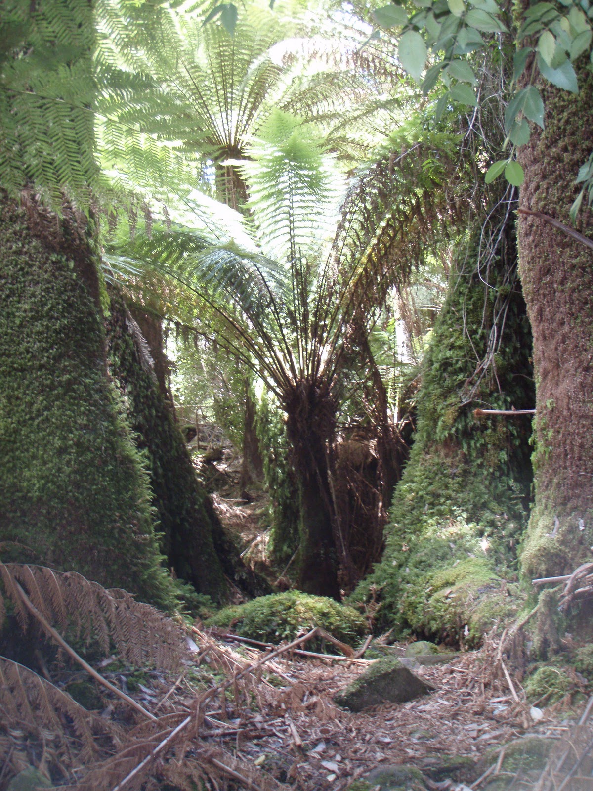
After about half an hour the track descends into a sheltered valley..it's quite a surprise and just beautiful. While resembling a cool temperate rainforest, by definition it is actually
known as a mixed forest as there is more than 5% cover of eucalypts. Underneath the large eucalypts is an understorey of Musk, Dogwood and Bedfordia, together with the rainforest species Sassafras and some very tall Treeferns. This area is such a contrast to the terrain we have just walked through. In the middle of it all is the most magical little babbling creek, it reminded me of the fairy glades I use to read about in my Enid Blyton books when I was young...ahhh so lovely. Took the opportunity to refill the drink bottle with the crystal clear water from the creek.


Time to move on from this little piece of paradise and back to the reality of the toughness of this walk. We now climb steeply...very steeply!! to a little rocky outcrop which takes in views of High Yellow Bluff and Maria Island. This is the great thing about these walks...it's a lot of effort and at times extremely challenging but the views that are experienced are breathtaking. Equally welcome was the sign telling us that Cape Surville was only 15 minutes away!!


 |
| High Yellow Bluff |
We now head east along the clifftop and onto a narrow ridge with the cliffs falling away steeply on both sides of the track...not for the fainthearted! With only a turn of the head there is a spectacular view of High Yellow Bluff on the left and to Sisters Rocks and Deep Glen Bluff on the right...magnificent!!
 |
| Deep Glen Bluff |
Some information for the geologically inclined...the cliffs to the right are like a huge layer cake, with the lower section composed of Devonian granite and the upper of Permian sandstone and mudstone. Cutting through these is an instrusion of black Jurassic dolerite. The fact that how this intrusion occurred can be seen in the cliff face makes this site unique...oh, and a geek's dream! By the way I did do a bit of research on the composition of the cliffs, haven't just made it up....my Year 12 geology teacher would be so proud!!
 |
| Sisters Rocks |
The track now continues along the south side of the headland until after a short walk we can climb up to the crest....yes we made it!!!


We're on top of the world...at least that's how it feels....2 and a half hours after leaving the car we have reached our destination, and it feels great! Time now for some lunch and a rest before embarking on the return trip.
The trek back takes us about an hour and a half...so the sign saying the walk is 2hours return is a complete firthy..no way, even allowing for lots of chat, photo ops and getting stuck under fallen trees, there's no way the walk could be completed in this time.
Once back at the car and after a short recuperation it's time to hit the road and head straight for the closest pub...cascade ale here we come!!
One of the great things about doing these walks is the companions that have accompanied me...all top class! Thanks Amanda for making this one so enjoyable...a great day!
 |
| looking back to where we'd been.....the top of the crest was our destination |
No comments:
Post a Comment