Wednesday, August 24, 2011

Walk Number 19..... Lime Bay to Lagoon Beach 21/8/2011

Well, pretty excited as I get to do a walk 2 weeks in a row...yahoo!!! Jane's pretty keen to see me achieve this challenge and as she's going away for a month has offered to come on another walk this week. 


The list of remaining walks contains a mixture of easy, medium & hard but many of the medium and hard graded walks should really be undertaken in the warmer months (well that's my philosophy anyway, would you really want to be out on the track for over 6 hours in the rain??) Although today is forecast as being fine we decided to notch up another easy graded walk......Lime Bay to Lagoon Beach.


To get to the start off point at the Lime Bay Camping Ground turn right off the Arthur Highway (A9) onto the B37 road just south of the Tasmanian Devil Park at Taranna.  Travel for approximately 9km and turn right onto the C341 Saltwater River Road near The Old Trading General Store at Premaydena.  Follow this road for 9.7km to an intersection, turn right into Coalmines Road and drive 6.7km to the Camping Area.


The walk starts at the northern end of the camping ground, where a fire trail leads behind the beach.  The trail, which turns into a westerly direction across the peninsula, is very easy to follow.  It passes through open woodland and coastal heath with a wide variety of plant species.


The track is good for observing wildlife and we had a wallaby jump out in front of us at one stage, there was also evidence of echidnas in the area from the numerous holes along the track, as well as a lot of the peculiarly shaped wombat poo! 


To the south of the track there is a large lagoon which hosts Black Swans and other water birds after a wet season.  It only took us about 35 minutes to come across the sand dunes which lead onto the beautiful Lagoon Beach.


This is an idyllic location....long white beach with crystal clear water and not another person in sight.....paradise!


After taking in the fabulous views of Sloping Island, Mount Wellington, Betsy and Bruny Islands, head right to the end of the beach to a small headland.


Sloping Island
Headland


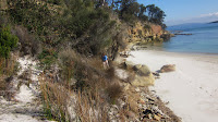
To get over the headland follow the taped track through the sand dunes to a number of small shell-covered beaches further on. We spent 2 hours in this area admiring the view and the unusual rock formations at the waters edge, as well as having a snack and a cuppa of course.  


This is really a very tranquil spot and the chances of running into any one else is quite remote.  You know people pay a lot of money to be able to enjoy the luxury of a secluded beach as beautiful as this one, and here we have it right on our doorstep...and we don't have to pay a cent to enjoy it.


Once you've finished having a look around the coves, head back to Lagoon Beach. To return to the camping ground either take the same route or walk to the southern end of the beach and cross through the sand dunes where you'll come across a track running north behind the dunes.  Continue close to the base of the dunes until the track meets up with the lagoon, which is about a 20 minute walk.  Once at the lagoon turn left and walk to the end of the lagoon where a track veers off to the right, this will lead you back to Lime Bay.  Returning via this route will take almost an hour.


Lagoon Beach
exiting from the beach


Sloping Lagoon


The sandstone cliffs in this area are quite a contrast to the dolerite formations of the three Capes (Hauy, Pillar & Raoul).  From what I understand from some research is that the constituent rocks of the Peninsula are sandstones deposited in the sea between about 300 and 200 million years ago.  About 165 million years ago, the landmass which is Tasmania was raised violently from beneath the sea.  During this process, molten dolerite was intruded between the sandstone strata. After millions of years of erosion, a large part of the sandstone surrounding the dolerite intrusions has been eroded away. This would account for the areas of the peninsula which are exposed to the harsh southerly conditions being predominately dolerite cliffs and those areas such as Lime Bay which are within the sheltered waters of Frederick Henry Bay being predominately sandstone.  The map below shows the orientation of the whole peninsula.  As I mentioned, this is my take on the situation, if I'm wrong please let me know....I find this all very interesting (sad I know).


Overall, this is a very pleasant walk and suitable for the whole family.  The weather on Sunday was perfect which just added to the experience.


Lime Bay

Lime Bay

Friday, August 19, 2011

Walk Number 18.....Fortescue Bay to Bivouac Bay 14/8/11

Finally the rain has stopped and the weather has shown a slight improvement so no excuses for not getting out amongst it.  Jane feels the same so we scheduled a walk for Sunday 14/8 and decided to head back to Fortescue Bay (the starting point of the Cape Hauy walk) and walk into Bivouac Bay.


This walk is graded as easy as it is suitable for all levels of fitness, is on clearly marked tracks with little in the way of natural obstacles.  You will experience some beautiful coastal scenery combined with pleasant walking through a varied range of vegetation. The walk is approximately 10 km's return and you should allow at least 3 hours return for this trip.


Accessing the track is by turning left off the Arthur Highway (A9), 3.5km south of the B37 junction at Taranna, onto Fortescue Bay road (C344).  Follow the signs for the next 12km to Fortescue Bay....the road is unsealed but suitable for 2WD vehicles, park in the Casuarina Day Use area.


Walk to the northern end of the beautiful white sanded beach where the track is signposted, passing the entrance to the lagoon, where wading maybe required if water is running out.


looking out from Fortescue Bay


The track climbs and follows the clifftop, passing through Stringybark and Blue Gum forest with an understorey including Bedfordia, Mountain Berry, She Oak and Prickly Wattle. After heading down to a small rocky cove the track climbs again back to the clifftops and heads north towards Canoe Bay.  From this vantage point there are views of Hippolyte and Cheverton Rocks and back to Fortescue Beach.  At this point you can look down into the clear waters of the bay with its magnificent beds of kelp, which can grow to the surface from depths of up to 25 metres.


After about an hours walking you will arrive at Canoe Bay which is a good spot to stop for a cuppa. This is a sheltered anchorage with a sunken dredge "William Pitt" acting as a breakwater. The "William Pitt" was originally a Dutch Trading Vessel named ANDR REBONCAS built in 1907 and was sold to the Hobart Bridge Company for 500 pounds in 1941 and renamed at that time. It was registered in Hobart as a Coal Hulk. She ended her working life to aid the war effort during the Second World War to act as an artificial breakwater.  Its new purpose was to provide shelter from high seas for a canning industry, an ice making works and a timber mill on the Peninsula.  Locals can recall how in the early 70's a storm lifted the wreck filled with chains and ballast and moved it to its present position.It is now in 6 metres of water and complete below the waterline.  It is a very popular dive site as it's in a sheltered position with good depth with an abounding marine life around it.


Canoe Bay

The 'William Pitt'


There is a camping ground on the shore and fresh water is available from Walkers Creek at the head of the bay, so if you're looking for a place for an overnight camp which has easy access then Canoe Bay would be a good choice.


After the refreshment break you now follow the track to the head of the bay.  Cross Walkers Creek by way of a suspension bridge.


The walk along the north shore enters a damp section of forest containing Treeferns and some large Blue Gums.  After about 10 minutes the track leaves the sea and climbs, quite steeply at times, before crossing a more open forested crest and descending through damp forest into a small gully. The track at this point was very sloppy and slushing through the mud was enjoyable (well I enjoyed it). The track now climbs briefly and then leads down into Bivouac Bay where there is a camping area with a toilet which is quite a luxury on a Peninsula walk. 


Bivouac Bay is a very pleasant spot and after a bit of rock hopping across a small body of water we found a nice sheltered spot to set up the cooker to enjoy lunch and have another cuppa.


Bivouac Bay


There is the opportunity to continue on past Bivouac Bay to Waterfall Bay which is another 4 hours walk, but that's one for another day.


The return to Fortescue Bay is by the same route.


One of the highlights of this walk for me was the prevalence of wildflowers and funghi along the way.  Overall this was a very enjoyable walk and I would highly recommend it as it's suitable for all fitness levels and the views from the coastline are as always quite spectacular.  So now that the weather seems to be on the improve (for the moment) why not get out and enjoy what Tassie has to offer...I know you'll love it!