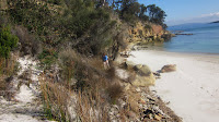
The list of remaining walks contains a mixture of easy, medium & hard but many of the medium and hard graded walks should really be undertaken in the warmer months (well that's my philosophy anyway, would you really want to be out on the track for over 6 hours in the rain??) Although today is forecast as being fine we decided to notch up another easy graded walk......Lime Bay to Lagoon Beach.
To get to the start off point at the Lime Bay Camping Ground turn right off the Arthur Highway (A9) onto the B37 road just south of the Tasmanian Devil Park at Taranna. Travel for approximately 9km and turn right onto the C341 Saltwater River Road near The Old Trading General Store at Premaydena. Follow this road for 9.7km to an intersection, turn right into Coalmines Road and drive 6.7km to the Camping Area.
The walk starts at the northern end of the camping ground, where a fire trail leads behind the beach. The trail, which turns into a westerly direction across the peninsula, is very easy to follow. It passes through open woodland and coastal heath with a wide variety of plant species.
The track is good for observing wildlife and we had a wallaby jump out in front of us at one stage, there was also evidence of echidnas in the area from the numerous holes along the track, as well as a lot of the peculiarly shaped wombat poo!
To the south of the track there is a large lagoon which hosts Black Swans and other water birds after a wet season. It only took us about 35 minutes to come across the sand dunes which lead onto the beautiful Lagoon Beach.
This is an idyllic location....long white beach with crystal clear water and not another person in sight.....paradise!
After taking in the fabulous views of Sloping Island, Mount Wellington, Betsy and Bruny Islands, head right to the end of the beach to a small headland.
 |
| Sloping Island |
 |
| Headland |
To get over the headland follow the taped track through the sand dunes to a number of small shell-covered beaches further on. We spent 2 hours in this area admiring the view and the unusual rock formations at the waters edge, as well as having a snack and a cuppa of course.


This is really a very tranquil spot and the chances of running into any one else is quite remote. You know people pay a lot of money to be able to enjoy the luxury of a secluded beach as beautiful as this one, and here we have it right on our doorstep...and we don't have to pay a cent to enjoy it.
Once you've finished having a look around the coves, head back to Lagoon Beach. To return to the camping ground either take the same route or walk to the southern end of the beach and cross through the sand dunes where you'll come across a track running north behind the dunes. Continue close to the base of the dunes until the track meets up with the lagoon, which is about a 20 minute walk. Once at the lagoon turn left and walk to the end of the lagoon where a track veers off to the right, this will lead you back to Lime Bay. Returning via this route will take almost an hour.
 |
| Lagoon Beach |
 |
| exiting from the beach |
 |
| Sloping Lagoon |
The sandstone cliffs in this area are quite a contrast to the dolerite formations of the three Capes (Hauy, Pillar & Raoul). From what I understand from some research is that the constituent rocks of the Peninsula are sandstones deposited in the sea between about 300 and 200 million years ago. About 165 million years ago, the landmass which is Tasmania was raised violently from beneath the sea. During this process, molten dolerite was intruded between the sandstone strata. After millions of years of erosion, a large part of the sandstone surrounding the dolerite intrusions has been eroded away. This would account for the areas of the peninsula which are exposed to the harsh southerly conditions being predominately dolerite cliffs and those areas such as Lime Bay which are within the sheltered waters of Frederick Henry Bay being predominately sandstone. The map below shows the orientation of the whole peninsula. As I mentioned, this is my take on the situation, if I'm wrong please let me know....I find this all very interesting (sad I know).


just did this walk yesterday and it is so good - I had been there once before in summer and the beach was amazing. I am intending to do the same with the walks on the peninsula marking them off one by one so will follow this with interest! Thanks for the post!
ReplyDelete