Today is very much an indulgence.....a walk on a Thursday!! My dear friend Janine is very enthusiastic about me completing this task that I've set myself and is also very enthusiastic in accompanying me on as many as possible....therefore she was my walking partner on today's trek.
The Clark Cliffs Circuit walk is graded as medium and timed at 3.5 hours for the round trip...in reality it is quite hard and took us over 4 hours to complete. While not one of my favourite walks it does provide a varied sample of the Tasman Peninsula's wet forest, a stimulating walk, and panoramic views from the inland cliffs. When I saw that this was a cliffs walk I naturally assumed coastal cliffs....knowing the topography of this area this was impossible....a blonde moment perhaps! This is a great time of year to do this walk as there is a wide range of funghi on display with colours to rival an artists palette.
To access the track for this walk turn right off the Arthur Highway onto the B37 road just south of the Tasmanian Devil Park at Taranna. Follow this road for approximately 4.5km and then turn left into Firetower Rd. Travel for 5.5km along Firetower Rd to a junction and a sign marked Clark Cliffs.
Funny thing about this walk is that Janine & I did it in reverse to the way the walks book describes it....quite inadvertently. When we arrived at the starting point (well what we thought was the starting point due to the quite clear signage) we started walking along the track, however after referring to the walks book realised after a while that the walk being described wasn't the one we were doing. The start of the track described in the book was actually another 500 metres down the road. Anyway, once we discovered our mistake we decided to continue and describe the walk from the opposite perspective. As can be seen from the above signage, we opted for the circuit walk.
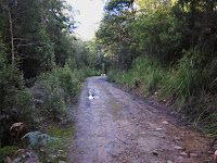
The track begins as a fire trail which is very easy to follow....this continues for 15 minutes or so. The first thing of note is the side track to a lookout with views over Koonya and Norfolk Bay.....well worth a look.
After admiring the view you will enter an area that was once a mill site and evidence of old selective logging is still visible with large stumps beside the track. These stumps have slots which were cut to support the boards on which fellers stood with their two-handed crosscut saws. The track now enters an area of remnant rainforest. The canopy is dominated by Myrtle with the occasional Stringybark towering above.
Another little side track beckons....Musk Forest, this is a very beautiful area dominated by Musk and Blackwood.
The track now passes close to the summit of Mt Clark through regrowth forest before emerging onto the top of Clark Cliffs, a series of dolerite pillars, which provide views over the southwest of the Peninsula.


From here on end the track follows Plummers Creek with the trail crisscrossing the tributary while descending very steeply through Dogwood, Bedfordia and Treeferns. While in general the track is reasonably easy to follow, orange tape and tags mark the way.
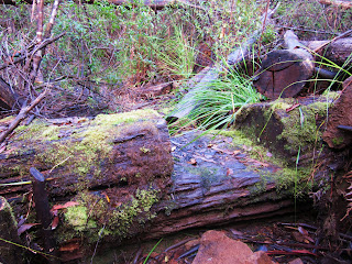
The next part of the track is the most challenging as it is descends quite steeply and is very wet and slippery.....I don't imagine that this changes all that much during the year due to being enclosed with vegetation. Towards the end of this walk the track becomes very difficult to traverse, several sections of it have been overtaken by the tributary which would be the result of large amounts of water flowing through in times of heavy rain. For most of the year rain falls at least every second day on the Peninsula, there are more rainy days here than on the Central Plateau....average annual rainfall is about 1180mm. In saying this though, I have been very fortunate with the weather on all of my walks so far...the generally mild temperatures in this area are excellent for walking.
As I mentioned earlier this walk is probably not one I would recommend enthusiastically but that's because my preference is for coastal walks and the sensational coastline views. However, like any walk, just being out exercising and enjoying our fantastic natural surrounds makes it so worthwhile.
Here's a small gallery of photos showing what to expect along the trail. Happy trekking!
 |
| fire trail at start of walk |
 |
| a trickier part of the track |
 |
| one of these things is not like the others! |
 |
| view of Norfolk Bay from the road back to Koonya |


No comments:
Post a Comment